Puxles has been one of the core companies for 8 consecutive years in the construction of the Geographic Information System for Pipelines – SIGOL, a web platform developed with ArcGIS technology, OpenSource frameworks, and integration with Microsoft Azure cloud, OpenText, SAP, SQL Server, ArcGIS Server, ArcGIS Online, among others.
This platform has been a product with a high level of quality and unique in its design, as it incorporates the PODS (Pipeline Open Data Standard) standard for geospatial management of pipeline data and its facilities. It can be managed by geospatial technologies such as ArcGIS and provides access to over 200 users throughout the organization.
SIGOL was designed using the FRONTEND/BACKEND pattern, where each backend API has its respective frontend library in Angular 16, aiming to achieve flexible maintenance over time. The backend is based on the Java 17 standard with an agnostic microservices approach using Docker containers, allowing for response times of less than 1 second for cold starts and load balancing of APIs during demand spikes. For this case, the Quarkus framework (https://quarkus.io) from Red Hat was implemented on Java 17 with Docker containers managing native binaries. SIGOL extensively uses various technologies and API specifications such as Hibernate, OIDC, REST, SOAP, Bean Validation, Interceptors, JTA, JAX-RS, and many others. In addition, it utilizes other frameworks for automated and agnostic testing such as Testcontainers, Jupiter, and JUnit.
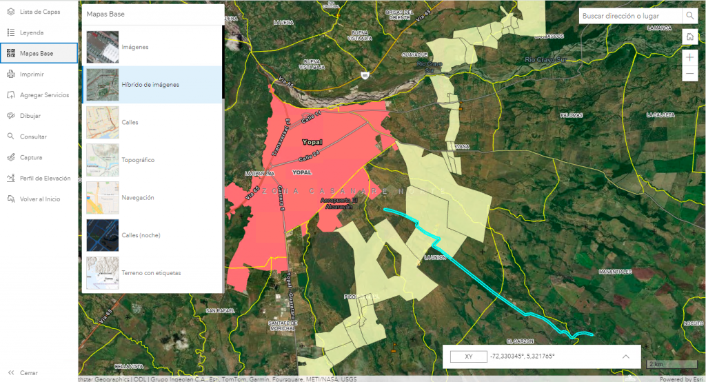
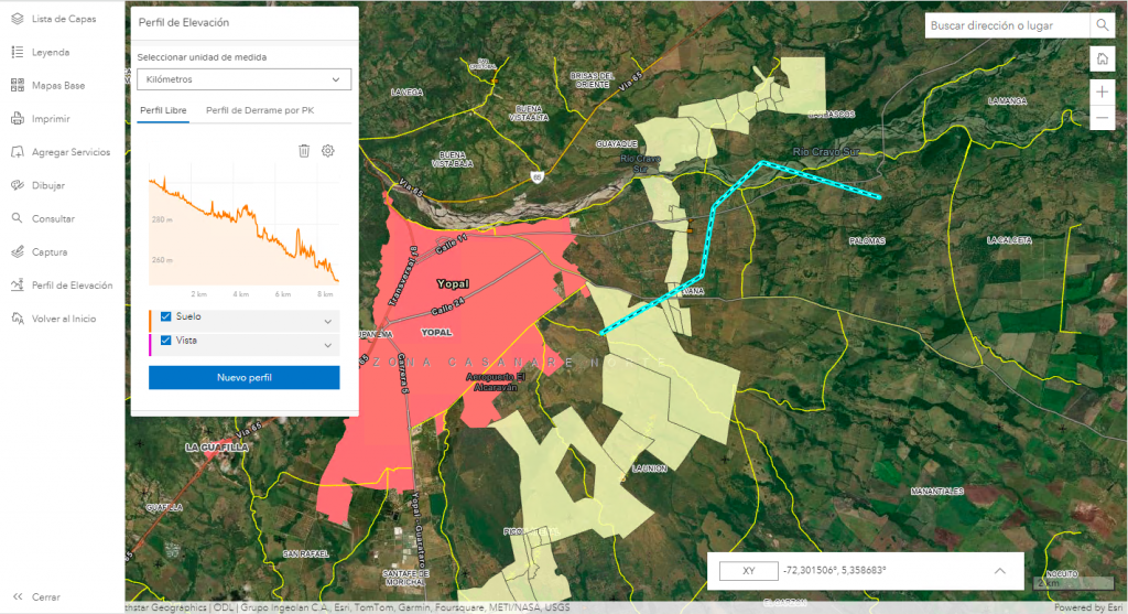
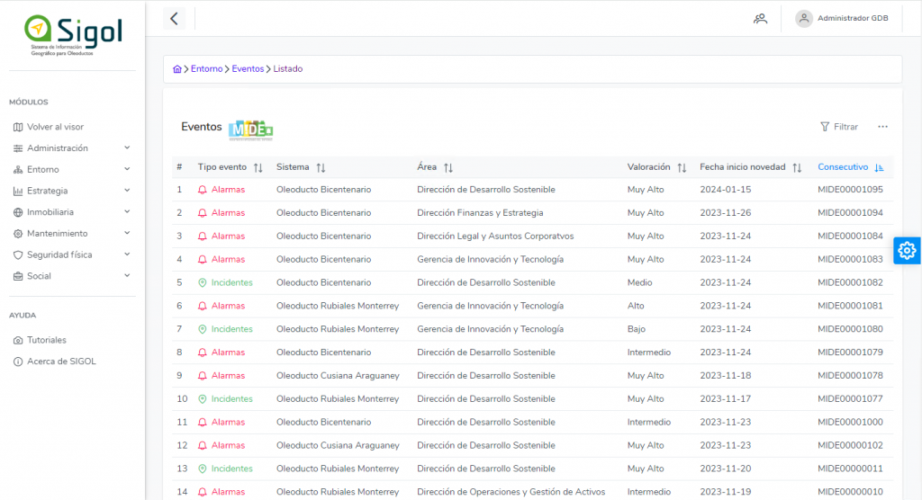
SIGOL becomes the geographic web platform for the Oleoducto de los Llanos Orientales, serving as the central point to access real-time information on environmental data such as discharges, water intake, solid waste (and four other modules), real estate (legal diagnoses, cadastral information, damage reports, reports), fieldwork (GPS point fieldwork), operations (maintenance and alerts on the pipeline), social and environmental monitoring events (MIDE), providing integration with other external information systems such as the OpenText document repository, SAP, Microsoft Azure, and Microsoft Office of the organization.